Why Environmental Baseline Data Collection is Important for Euro Sun Mining
Euro Sun Mining’s Rovina Valley Project will be evaluated on multiple factors. It will be assessed on how its copper contributes to Europe’s energy transition, the number of local jobs created, the success of regional gentrification, and the improvement of infrastructure in Hunedoara County. However, an equally critical factor in this evaluation is the project’s environmental stewardship and its relationship with the natural ecosystem.
For Euro Sun Mining, environmental baseline data collection remains a key activity at every stage of the project—from exploration and development to full-scale operations. Establishing a reference point for existing environmental conditions ensures compliance with regulatory requirements and helps minimise future ecological and social impacts.
Key Elements of Our Environmental Baseline Data Collection
- Physical Environment
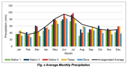
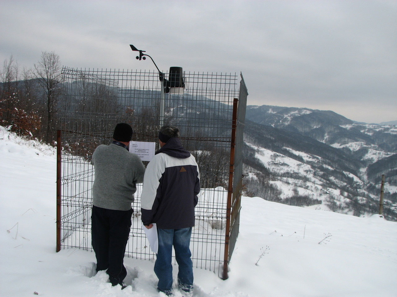
- Climate & Meteorology: For over a decade, Euro Sun Mining has measured and recorded temperature, precipitation, humidity, and wind patterns using weather stations distributed throughout the mining concession.
- Geology & Soil: Extensive mining drill programs have provided critical environmental data on soil composition, stability, erosion potential, and possible contamination.
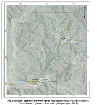
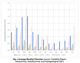
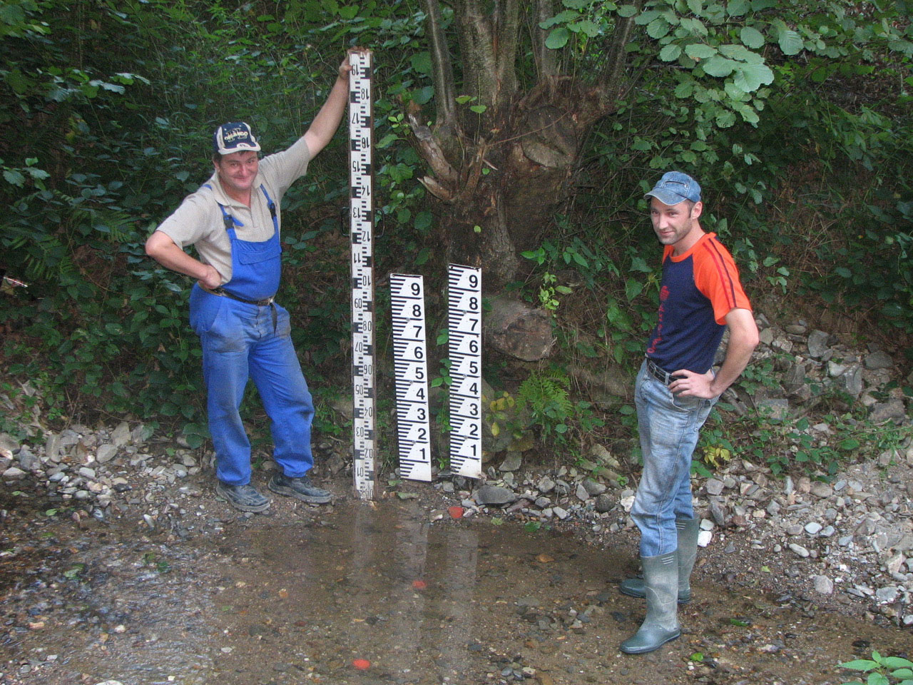
- Hydrology & Hydrogeology: Monitoring surface water bodies, groundwater levels, flow rates, flow direction, and overall water quality is crucial in mine planning. All data is verified by independent experts.Monthly flow charts of streams give a baseline of water hydrology around the site. We have 4 gauges in the main creeks to record flow.We record on a quarterly basis underground water level in 6 hydrogeological drill holes using piezometers and vibrating wire piezometers.
- Air Quality: Baseline air quality measurements include dust, gases (CO₂, NOx, SO₂), and heavy metals.
Guiding our project, Euro Sun Mining has a formidable team of some of Romanians top engineers, some of whom also have doctorships in their various disciplines.
- Biological Environment
- Flora: The concession area contains indigenous vegetation that regenerates quickly. Satellite imagery and ground truthing techniques are used to map this vegetation. The mine plan covers only 4 square kilometers, and for every tree removed, Euro Sun Mining has committed to planting three trees.
- Fauna: Due to the relatively small footprint of the project, the impact on wildlife species is deemed minimal. Livestock grazing and hunting activities will be curtailed during the life-of-mine.
- Aquatic Life & Water Quality: Sampling of rivers and groundwater has been conducted to establish a baseline for metals, pH, turbidity, and nutrients. A small stream may require some diversion, but fish populations, water biodiversity, and overall ecosystem health will remain unaffected.
Every waterbody around the concession undergoes analyses monthly to enable a comprehensive baseline
- Socio-Economic & Cultural Environment
- Land Use & Zoning: Current land use data has been mapped, and future development plans are available for public review.
- Population & Demographics: In collaboration with local governments, Euro Sun Mining tracks population trends in Criscior and Brad, analysing household livelihoods and employment patterns.
- Indigenous & Cultural Heritage: While no cultural heritage sites exist within the mining area, nearby sacred sites are designated for restoration and preservation once mining operations begin.
- Public Health & Safety: Euro Sun Mining works within European legislation and alongside local governments to ensure that baseline health and safety conditions are an integral part to the mine plan.
How Does Euro Sun Mining Collect Its Data?
- Field Surveys & Sampling
- Soil & Rock Testing: Laboratory analysis to assess geochemistry, contaminants, and Acid Rock Drainage (ARD) potential.
- Water Sampling: Regular monitoring of surface and groundwater quality.
- Air Quality Monitoring: Air sensors to measure dust and emissions.
- Remote Sensing & GIS Mapping
- Satellite imagery & drone surveys to analyse terrain, vegetation cover, and water bodies.
- Geospatial analysis for land use planning and impact prediction.
- Community Engagement & Stakeholder Consultation
- Surveys and interviews with local communities, government agencies, and environmental experts is ongoing and the Euro Sun Mine offices are open for public engagements.
- Social impact assessments to identify concerns and mitigation strategies.
- Review of Existing Data & Reports
- Examination of historical environmental studies, previous environmental impact assessments and geological assessments.
Why We Pride Ourselves on Baseline Data Collection
✅ Regulatory Compliance: Ensures adherence to environmental laws and mining permits.
✅ Impact Prediction & Mitigation: Helps model potential effects of mining activities and plan mitigation strategies.
✅ Environmental & Social Responsibility: Supports sustainable development and community relations.
✅ Long-Term Monitoring & Rehabilitation: Serves as a benchmark for future restoration and mine closure planning.
By prioritising comprehensive environmental data collection, Euro Sun Mining ensuring that the Rovina Valley Project meets the highest sustainability standards, contributing positively to the local economy and the European energy transition while maintaining environmental integrity.